Web Apps using ArcGIS Online
IN PROGRESS...............................................
ESRI javascript API example - point cluster map of crimes in Buffalo, NY in 2020
.The section covers making web mapping applications in ArcGIS OnLine. In many ways, this topic should precede Making Maps in ArcGIS OnLine because the type, structure, and design of an app influences the number and design of maps incorporated into the app. Another example of the "chicken and egg" problem and GIS!
ArcGIS Online has a wide variety of web mapping application templates available to users. These templates may be customized online or downloaded for customization. One very popular application is a Dashboard. Dashboards display data on maps and include other means (charts, graphs, text) to summarize and visualize data. Two example dashboards are included here.
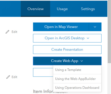
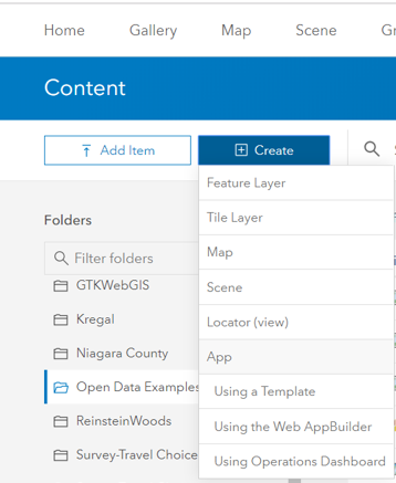
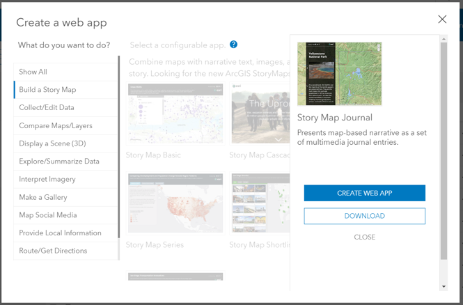
As with all things GIS, you can create a web app from many different locations in ArcGIS OnLine. For example, in the map view the SHARE Button allows you to create a web app. Also, you can create one from a wep map's details page (top right image) or from the CONTENT folder (bottom right image). If you choose to create a web app from a web map view (map or details), the assumption is that the map you are working with is the map to be incorporated into the app. If you choose to create a web app from the content page, you will choose the map(s) to include as you design the app.
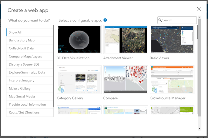
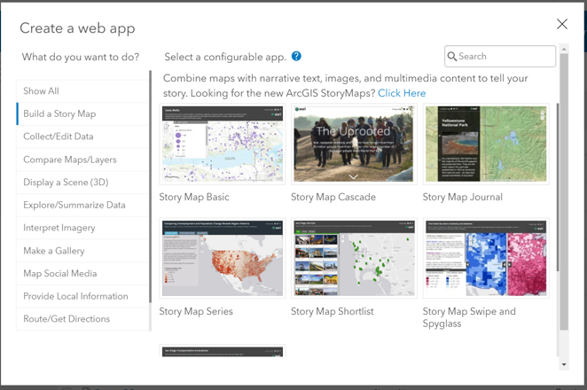
In any case, if you are building a wep app from a template, you will see a window (gallery) showing the wide variety of web app templates that are available.
Story Maps
5 Principles of Effective Storytelling: May 31, 2018
Link to ArcGIS Story Maps Overview
Below is a link to a Journal Story Map
on the social determinants of health by census tract. All of the data used to make these maps were extracted from the Census Bureau ACS datasets, the USDA ERS datasets, and City of Buffalo Open Data Portal.
Feature layers were built using ArcGIS Desktop and feature services built on SUNY BSC ArcGIS Server.
Several web maps were made in ArcGIS Portal and incorporated into the journal storymap template. The template was customized in Portal.
Link to SDOH Journal Story Map
Web AppBuilder
Web AppBuilder is available only to those with an organizational account. Web AppBuilder Documentation
Web AppBuilder uses a single map that may have many feature layers. Several widgets that control app functions (like choosing a basemap) are available. Adding widgets to an app allows you to customize the look and feel (operation/functionality) of a web app. Available widgets include somewhat sophisticated GIS tools (such as Edit, Suitability Modeler, or the Situation Awareness widget) which may not benefit app users who not familiar with GIS. You can learn more about the 2D widgets here. Most of these are beyond the scope of an introductory web mapping course, but I encourage you to investigate all of the widgets. If you enjoy coding, you can create you own customized widget, too (using the developer's edition!).Building Web Mapping Apps is often a lengthy process that requires a lot of front end design and back-and-forth with data and maps to achieve the desired final result. As with any skill, the more experience you have, the better you will become at creating apps. In short, creating really good apps takes a lot of hard (but enjoyable and rewarding)work!
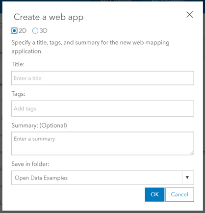
When you choose Using the Web AppBuilder select 2D (based on maps) or 3D (based on scenes) as the app type, provide a title, and other information about the app. When you click OK you will enter the edit screen for your app.
Social Determinants of Health in Western New York by zip code
This web mapping app was built using ESRI's Web AppBuilder in Portal. Widgets, Splash screen, searchable layers are features of this app.
Link to AppErie County Internet Services by zip code
This web mapping app was built using ESRI's Web AppBuilder in Portal. Widgets, Splash screen, searchable layers are features of this app.
Link to AppInternet access in Western New York: by census tract and zip code.
This web mapping app was built using ESRI's Web AppBuilder in Portal. Widgets, Splash screen, searchable layers are features of this app.
Link to AppDASHBOARDS
Dashboards have become a very popular approach to visualizing data in a variety of ways on one screen! ArcGIS online offers tools to create a map-based dashboard. Data displayed on a map (and in map layers) may be summarized in charts and graphs, lists, detail pop-ups, and other elements. These elements may be made to interact with each other. For example, when a user zooms in on the map, information in other elements in the dashboard may change.
Dashboards may seem quite complicated, to even the most experienced users. As evidenced in the examples below, users would benefit from help text to understand the interactions between the elements.
Western New York Internet Access Dashboard
Western New York Internet Speed Test June 2020